Join other industry-leading organizations pushing boundaries and solving problems with Spacesium.


Enterprise technology that
connects location and data.
The new Spacesium propriety technology provides instant visibility
into all project aspects, including 3D survey data compared to 3D
CAD models and automated analytics.
Professional mapping.
Accessible for everyone.
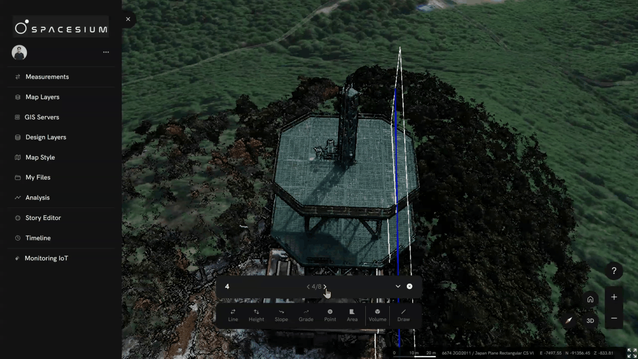
Measurement Tools
More measuring.
Less Delays.
Accurate volumes.
Take full control of your construction, mining, environmental, surveying, asset, and drone projects with our advanced measurement and monitoring tools.
Track real-time progress, adapt instantly to design or schedule changes, and keep every phase seamlessly connected for maximum efficiency and project success.
Scaled Geo-intelligence
Automatically fast
and repeatable.
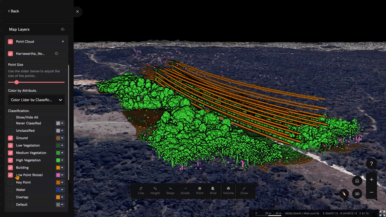
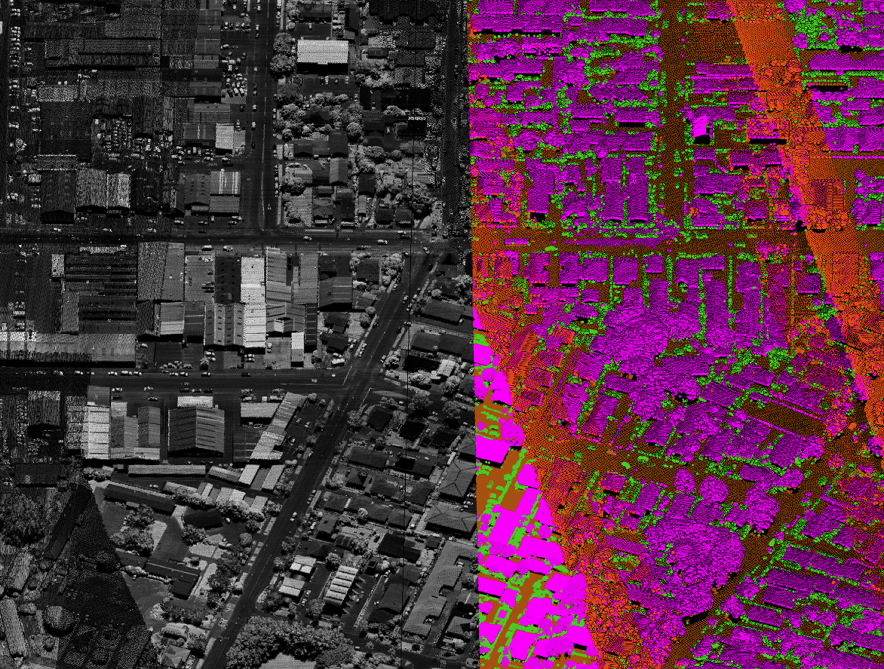
Accurate machine learning starts with efficient feature extraction.
Our expert team specialises in precise data classification — from ground and vegetation to buildings and complex structures.
Harness our powerful, adaptable machine learning tools to streamline your extraction process and accelerate results.
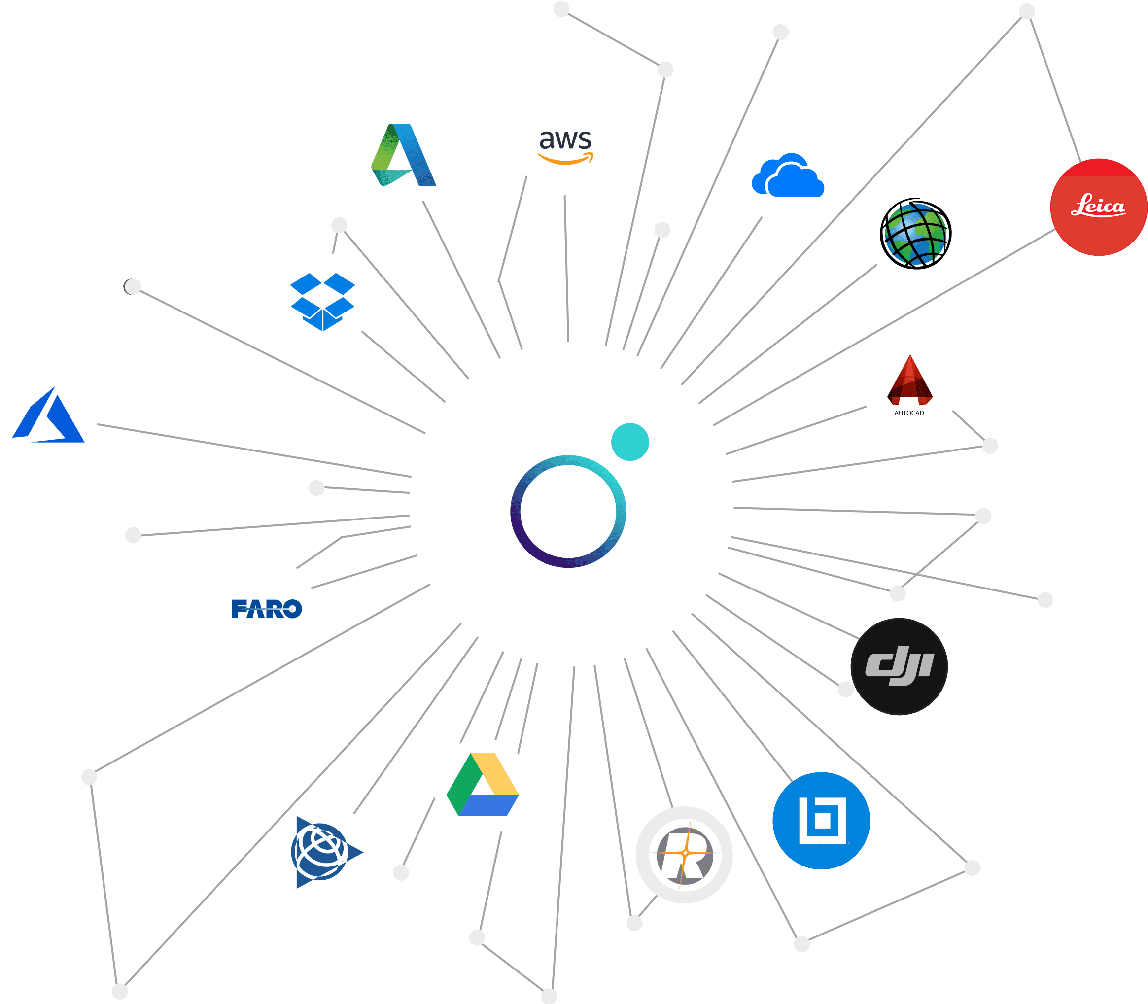
Interoperability
Plays fair with
Enterprise Apps
Successful projects start with seamless connections.
Our approach to work with various environments allows our technolgy to be scaled out in small and large enterprises.
Using our innovative technology — including patent-pending tools, we dploy on Linux, Windows, AWS, Azure, local servers with vendors such as ESRI, Mathworks and many more.
Powerfully simple.
Experience the ease, speed, and security of 3D mapping with
Spacesium, which offers unparalleled performance and quality.
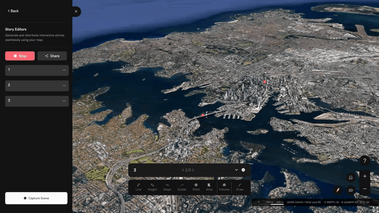
Tool Bar
The measurement tool bar is a collection of various measurement tools designed to provide accurate and efficient measurement capabilities for users.

Navigation
You can visually organize your
measurements and modify them as needed.

GeoAi Analytics
Our solution provides on-demand self-service analytics for companies and clients, with powerful custom-built geospatial analytics using the latest coding standards.

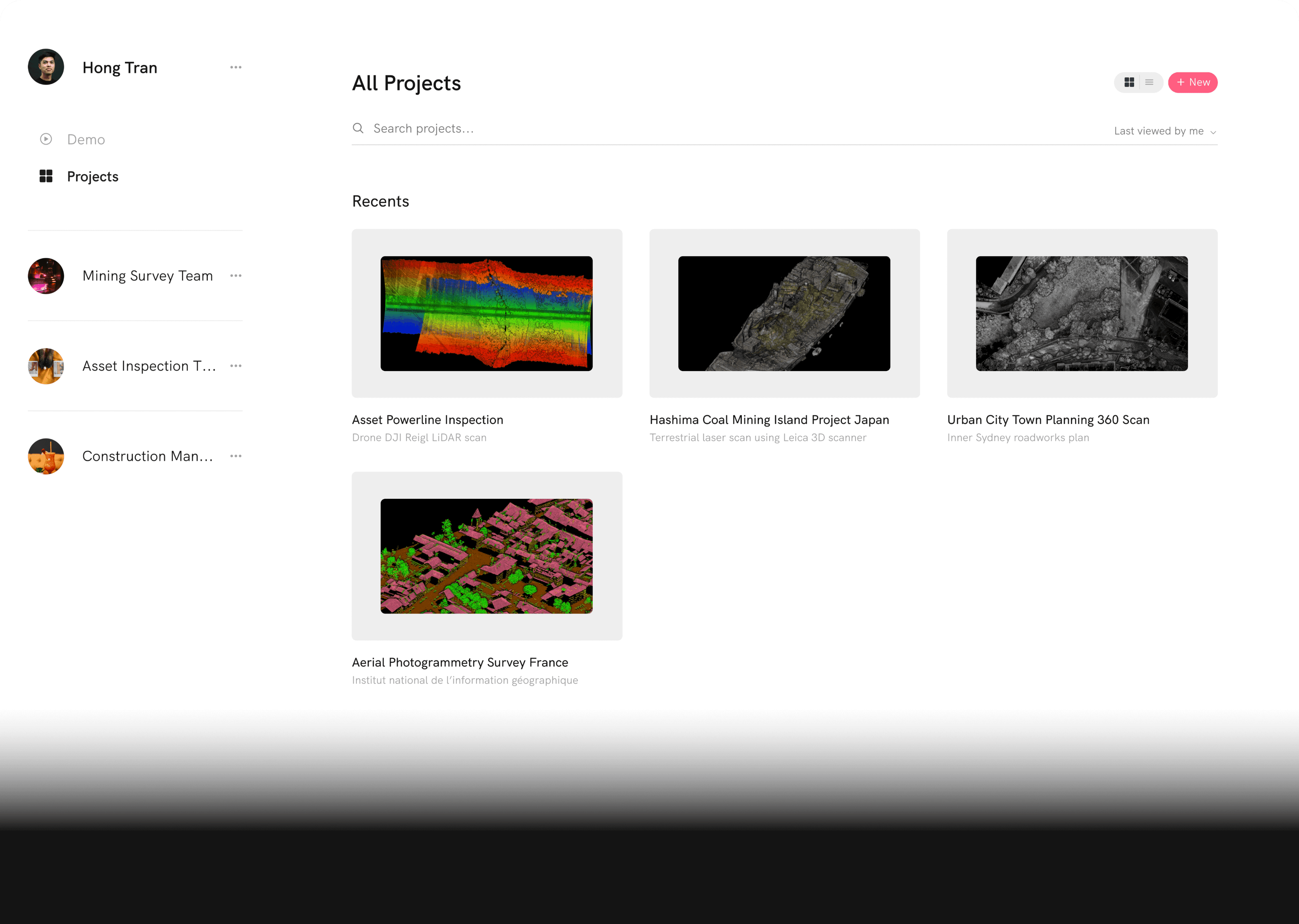
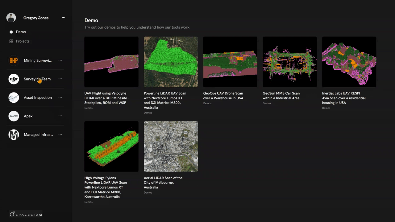
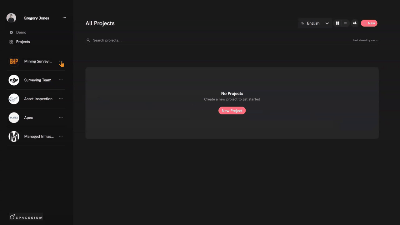
Efficient File Management
Designed to help organizations manage their files efficiently. With its user-friendly interface and robust features, Spacesium provides a powerful solution for organizations looking to streamline their file management processes.

Empower your team with tools and resources at your fingertips.
Get instant access to all the information you need to manage your infrastructure projects with our intuitive web application.
Spacesium technology, data, and services can help optimize workflows for surveyors, planners, engineers, GIS professionals, mine managers, and developers.
Processing
Development Kits
We develop and deploy custom applications on Linux, Windows docker systems for full integrations.
With our software data transformation services, you can easily integrate this data into your internal systems with our API and SDK functions. Speak to our technical team now.
We focus on Spatial Analytics. We build software that’s used by hundreds of sites worldwide. And we’re serious about creating reliable prediction, optimisation and decision support tools for mining, surveying and geospatial professionals.
SCDT enables users to automate the detection of changes between time-stamped point clouds, photogrammetry models, or raster datasets.
Whether monitoring pit progression, tracking tailings dam lifts, or detecting stockpile movement, Scout Shift simplifies complex geospatial analysis into clear, actionable insights.
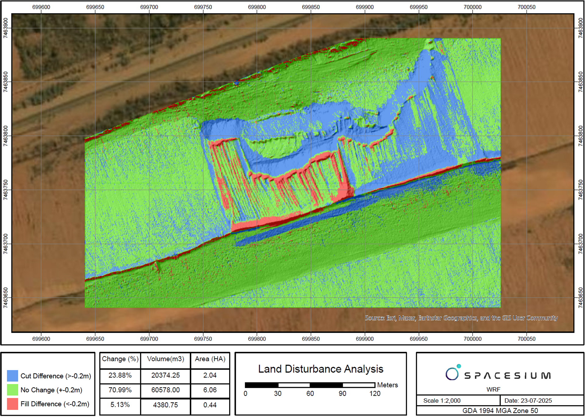
StockScanIQ is a automated volumetric analysis tool developed by Spacesium for ArcGIS users working in mining, construction, and infrastructure.
It leverages drone, LiDAR, and photogrammetry data to deliver automated cut/fill and stockpile volume calculations directly from classified point clouds.


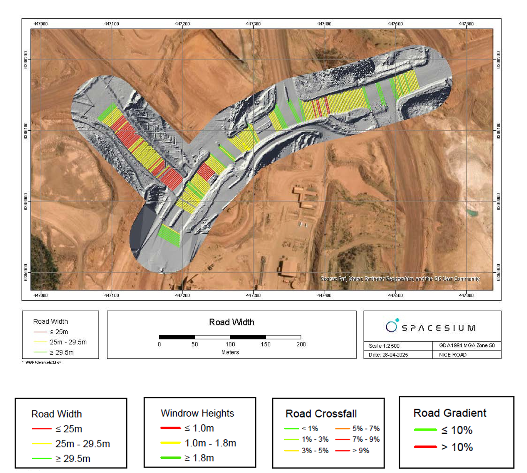
(RSCT) is setting a new standard in haul road safety and compliance monitoring.
By simply running the software, mining operators can instantly visualize road compliance, with data-driven insights highlighting areas of risk through automated detection, measurement, and reporting.

Spacetools is Spacesium’s lightweight, high-speed geoprocessing framework designed to enhance and accelerate point cloud preparation for ArcGIS and Esri-based environments.
Offload compute-heavy tasks—like tiling, DEM generation, point cloud classification, and contour extraction—to Spacetools, freeing ArcGIS for high-value analysis.
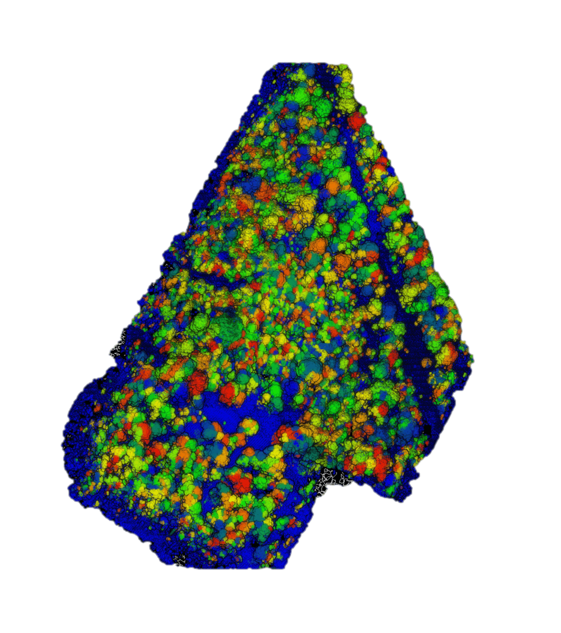
ScoutTree is Spacesium’s AI-powered tree segmentation tool designed to accurately detect, isolate, and analyze individual trees from 3D point cloud data. Seamlessly integrated into ArcGIS workflows.
ScoutTree empowers users to perform high-resolution vegetation mapping for forestry, environmental monitoring, land management, and site planning.
MineLiDAR has been utilizing the full potential of their current lidar technology. Spacesium’s tree segmentation algorithms were crucial for MineLiDAR/EnviroCapture, in particular endeavors focused on carbon farming projects spanning across Australia.

The deliverables provided were not only accurate but also accompanied by valuable insights, showcasing their expertise and dedication. I highly recommend Spacesium to anyone seeking top-notch geospatial solutions.

Thanks to Scout 3D's site simple data sharing capability, we've achieved a remarkable 30% boost in efficiency, directly benefiting our clients. This added value enhances our customer experience significantly thought-out all of our customers in Japan!

Our drone surveying capabilities have reached new heights, enabling us to unlock valuable insights and drive greater efficiencies in our projects. Their commitment to innovation and excellence has truly set a new standard in the field of spatial data analysis.

The solution not only facilitates the exchange of CAD files but also integrates scan data seamlessly, giving us a comprehensive view of our projects like never before. With Spacesium, we can collaborate while leveraging the latest advancements in advanced spatial technology to collaborate on one platform.